


-
{{ item.quantity }}
Sydway WallMap - Rolled & Laminated
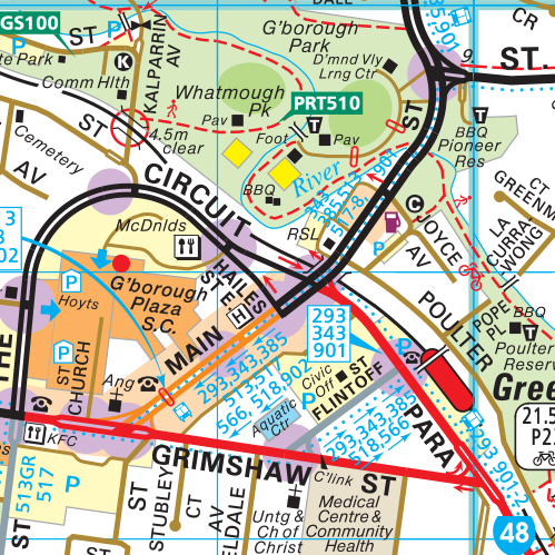
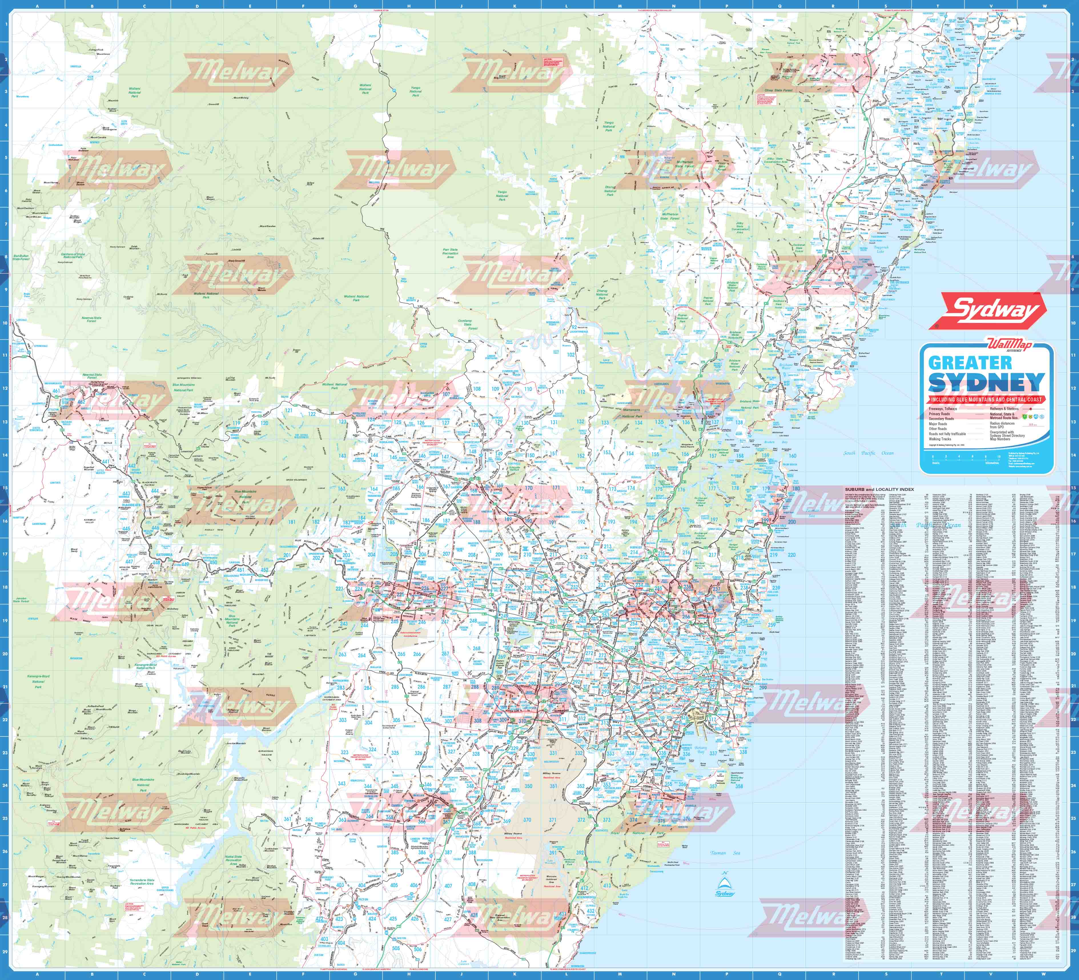
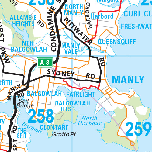
WallMap of greater Sydney covering from Belmont in the north to Picton and Helensburg in the south and in the west to Lithgow.
The Sydway WallMap was released in April 2008. It covers from Belmont in the north to Picton and Helensburg in the south and in the west to Lithgow. This wallmap includes radius lines with distance intervals from the CBD. It is overprinted with Sydway Street Directory Map Numbers and has an index of suburbs and towns with postcodes.
Our wallmaps come laminated for extra protection. Please contact our Sales Office if you require the map unlaminated. Custom sizes can be supplied upon request. Please phone 1300 MELWAY for a quote.
Size 1055mm (w) x 960mm (h).